

Reveal what's hidden.
Geolitix is a cloud platform for GPR data analysis that harnesses the power of cluster computing and machine learning to enable rapid, accurate data delivery for projects of any size.
Geolitix was designed from the ground up to automate the flow of data editing, processing, interpretation and reporting for utilities mapping. Geolitix offers a drag-and-drop interface that allows you to easily transfer data from all major radar manufacturers. Geo-referencing using an arbitrary XY grid or GPS data is simple – you can easily edit the positioning information to ensure all of your data is positioned perfectly.
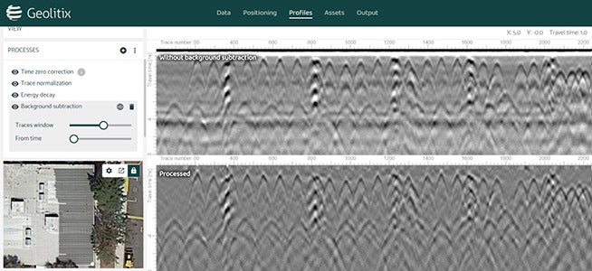
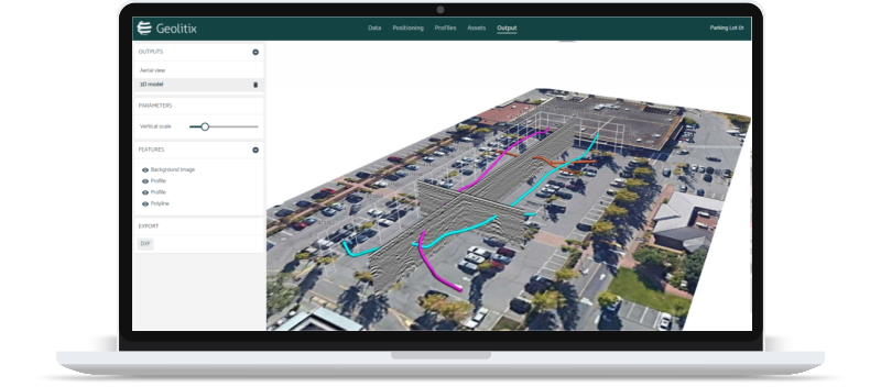
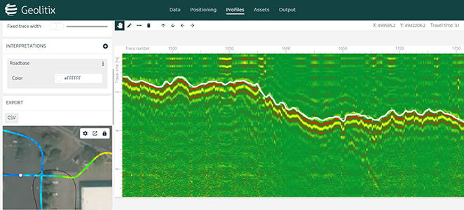
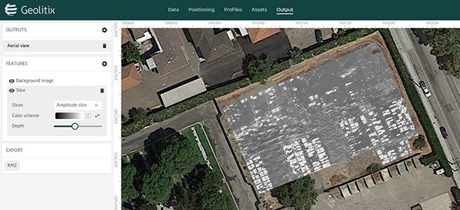
Processing involves time-zero correction, gains and filters, including migration and envelope functions. By exploiting the speed of clustered computing, these computations can be performed in real-time on all of the profiles in your dataset, regardless of its size. Interpretations can then be generated in a 3D-aware environment to show pipes, rebar and horizons. 3D data from large datasets can be sliced in a fraction of the time previously required using old PC-based software, allowing output of isosurfaces, slices and interpretations – all geo-referenced for easy input into your report, CAD/GIS software or Google Earth™.
*This software is accessed through a monthly or annual subscription.
