Skip to content

EMLID Reach RS2 (RTK GPS) For Rent

by EMLID
$80.00
SKU

Two Reach RS2 receivers are required for surveying in RTK and PPK modes

For used and refurbished options, call 1 (770) 674-2489.

  • Product Overview
  • Technical Specifications
  • Resources
  • Accessories
  • PPP support

    RINEX raw data logs are compatible with PPP services so you can now get centimeter-precise results in any place on Earth. Process RINEX files in an online service and get position with absolute accuracy.


    Built-in 3.5G modem

    Reach RS2 features a power-efficient 3.5G HSPA modem with 2G fallback and global coverage. Now corrections can be accessed or broadcasted over NTRIP independently, without relying on an Internet connection on your phone.


    22 hours on 1 charge

    Up to 22 hours of autonomous work when logging data and up to 16 hours as a 3G rover, even in cold weather—no more need to carry spare batteries with you. Reach RS2 can charge from a USB wall charger or a power bank over USB-C.


    Easy to use App for Mobile Phone

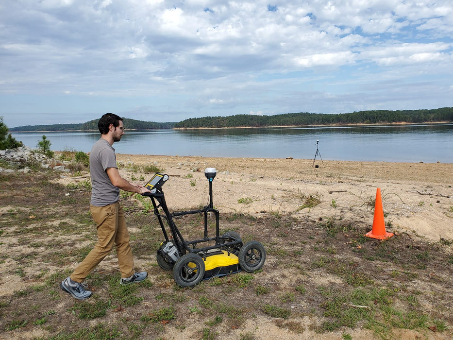
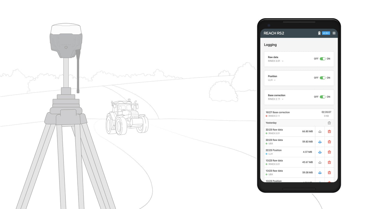
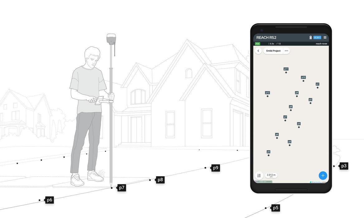
    The most user-friendly software for data collection that is available both for Android and iOS. With ReachView, you can collect and stake out points and control all the features of Reach receivers, such as setting up a base station, logging RINEX data, and configuring NMEA output.

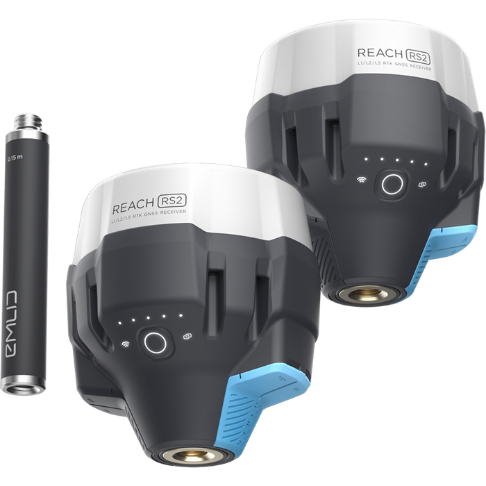
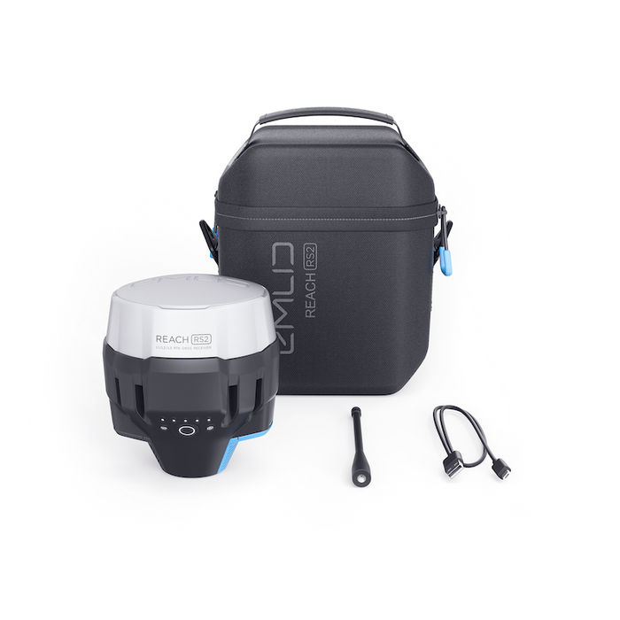
    Two full packages, each includes
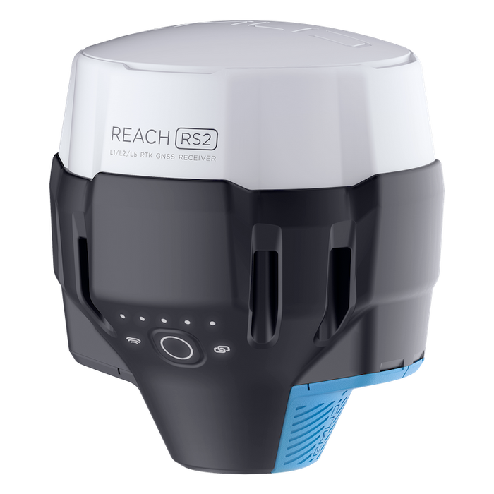
    — Reach RS2
    — Carry case with a strap
    — Radio antenna
    — USB Type-C cable

  • Centimeter accuracy for surveying, mapping and data collection.
    GNSS, GPS/QZSS, GLONASS L1, L2;
    BeiDou B1, B2; Galileo E1, E5
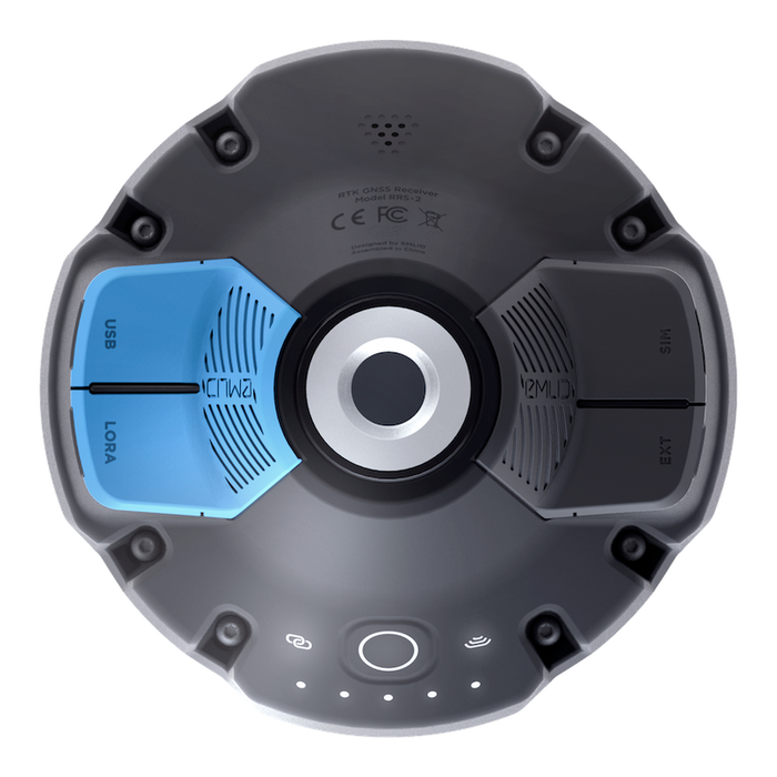
    Long range radio
    LoRa 868/915 MHz, range up to 8 km
    16 hrs as 3.5G RTK rover
    LiFePO4 battery, 6–40V input, USB charging
    Wi-Fi and Bluetooth For connection with other devices

    Get a Fix in Seconds

    Reach RS2 gets a fixed solution in just seconds and maintains robust performance even in challenging conditions. Centimeter accuracy can be achieved on distances up to 60 km in RTK, and 100 km in PPK mode.

    GPS, GLONASS, BeiDou,
    Galileo, and QZSS
    L1OF, L2OF, L1C/A, L2C,
    E1B/C, E5b, B1I B2I

  • Links

  • List